Achievements, challenges and vision on ensemble forecasting at Quebec’s government
Contributed by Thomas-Charles Fortier Filion
 Quebec holds the largest freshwater resource in Canada, with 175,000 km², with more than 500,000 lakes, and 4,500 rivers. It represents 3% of the world renewable water. As in other provinces of Canada, provincial government is the primary manager of water, responsible for most of the environmental regulation, and policy making that affects water issues.
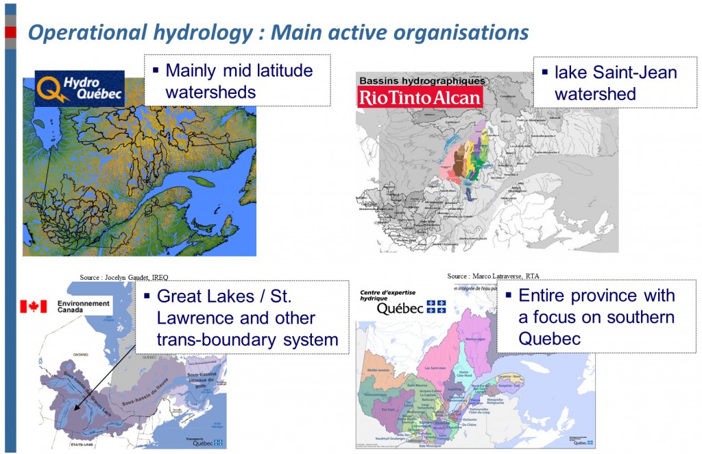
Hydrological forecasting is ongoing in Quebec since the 70s. The main organisations developing forecasting tools are Hydro-Quebec, and Rio Tinto Alcan, mainly for the optimisation of hydroelectricity production, and the CEHQ (Centre d’expertise hydrique du Québec) for conciliation of multiple uses for public dams, and public safety.
CEHQ is an agency of the Quebec’s Ministry of the Sustainable Development, the Environment and the Fight Against Climate Change (in French, Ministère du Développement durable, de l’

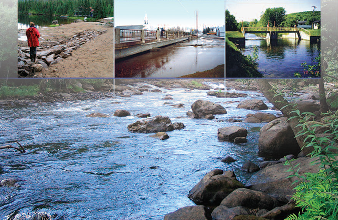
Saguenay’s flood in 1996
The Governmental Quebec’s flood forecasting service was set up after the major 1996 Saguenay’s flood. Since the late 90s, CEHQ has been forecasting for public dam management.
There are 700 public dams (44 managed in real time), which have multiple objectives and usages (water supply, flood control, leisure, energy production, etc.).

Richelieu’s flood in 2011
In 2011, a major flood occurred in the Richelieu River Basin and authorities have decided that flood forecasting for public security purposes would also be developed.
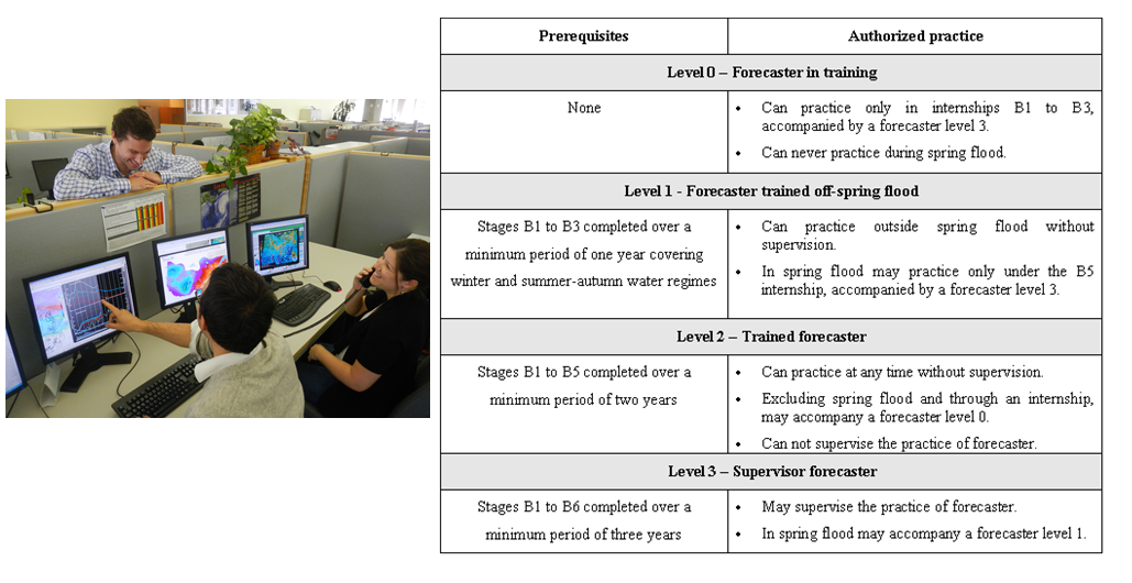
 CEHQ flood forecasting team has 2 coordinators, 7 operational forecasters, 2 computer scientists and 1 science advisor. To become a ‘supervisor forecaster’, a forecaster has to go through several levels of training as shown below:
- improve flood forecasting tools, focusing on the post-processing of uncertainties including calibration, and application of error models. Two models have been tested: one depending on forecast horizon and season, the second model depending also on the mean flow over the past 6 hours;
- improve the dissemination of the forecasts on internet (historical and real time data, as well as forecasts). See here for an example of dissemination.
Main operational issues for the implementation of ensemble streamflow forecasts are:
- Public Security:
- Quantification of the uncertainty on the timing of the peak flow is crucial.
- Dam management:
- Tools to assist in decision-making are both complex and rare.
- There is no absolute criterion helping decision-making for multi-purpose dams available.
- Decisions based on the deterministic forecasts are easier to explain.
- Uncertainty evolves quickly in short terms.
- Rapid availability:
- Decision support needs to be developed.
- Acquisition time and running time need to be improved (currently, forecasts are available around 10 am).
Finally, at CEHQ, operational developments go hand in hand with collaboration with research institutes. Our main collaboration today is with Université Laval, Chaire de recherche EDS en prévisions et actions hydrologiques (CRPAH).


October 7, 2014 at 06:48
Interesting article… Could you say a bit about the mechanics of how you generate your forecast uncertainty (incertitudes: 25e et 75e centiles”). This looks like it might be post-processing of a deterministic forecast with the uncertainty width based on historical errors?
October 20, 2014 at 14:33
You are right; it is indeed a post-processing of a deterministic forecast with the uncertainty width based on historical errors.
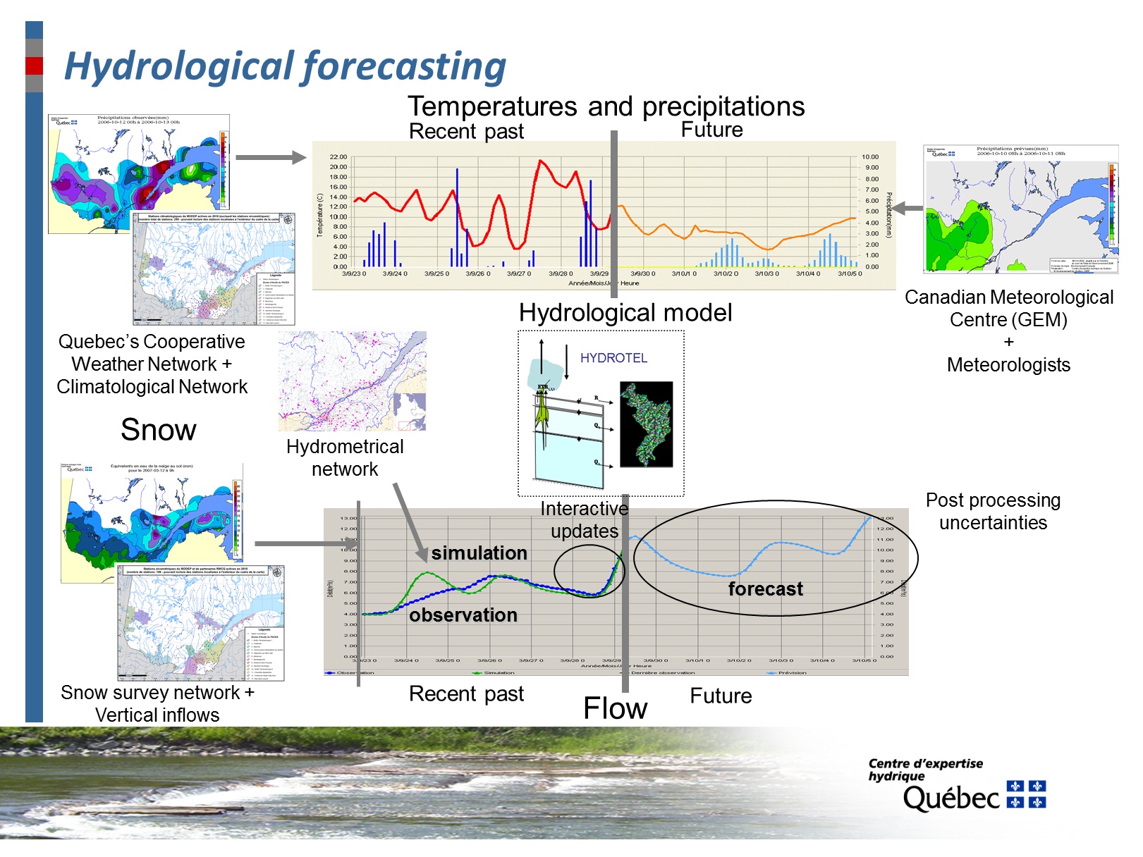
We developped an uncertaity model. The methodology of that study was based on forecasting errors over a historical forecasting period (2003 – 2012) of no more than 10 years. Ten sites located along rivers unaffected by dam management were analyzed and used as the forecasting framework. On the basis of this background, the statistical features of forecasting uncertainty were studied for a determinated season along a forecast horizon. A confidence interval containing 50% of the forecasts, designated as between the 25th and 75th percentiles, was selected not only to point out the presence of uncertainty, but also to present a narrow decision-making interval.
In developing the uncertainty model, the analysis of the physiographic variables (slope, land use, shape of drainage basin, etc.) did not reveal any significant differences in the uncertainty structure in terms of the sites that were studied. Accordingly, the uncertainty model defined was similar for all the forecasting sites. Explanatory hydrometeorological variables (precipitation, snowpack, previous flows, etc.) showed potential for discriminating between a variety of situations that could lead to different forms of uncertainty. As a result, a number of uncertainty models that use these explanatory variables were tested on a preliminary basis. At the end of the line, a very simple model that uses seasonal linear approximation of mean historical uncertainties over the forecasting horizon (Figure 2) was adopted. We felt that this decision allowed for an understandable and coherent message that could communicate the level of uncertainty to non-specialist users. We nevertheless felt that it was essential to add to this model an uncertainty measurement for the occurrence of hydrological events (ranging from ± 6 hours in the initial segments of the forecasting horizon to a maximum of ± 12 hours over a five-day horizon) in order to factor in the potential gap between actual observations and the forecast events.
The current uncertainty model is designed to provide an overview of scale for users who are not very familiar with the new kinds of data available from hydrological forecasts. However, in the near future, the CEHQ would like to be able to use dynamic uncertainty modelling that would factor in a variety of other variables, including ensemble forecasting.