Developing a pilot surface water flood forecasting tool for Glasgow and operational use during the Commonwealth Games
Contributed by Linda Speight
This year, the 2014 Commonwealth Games were held in Glasgow and everyone in Scotland was keen for it to be a success. Glasgow however has a known history of summer surface water flooding (2002, 2007, 2011, 2012, 2013). The Scottish Flood Forecasting Service (SFFS) is responsible for flood forecasting in Scotland, and we felt that if heavy rain was to occur, our existing surface water forecasting capabilities would not be sufficient to meet the expected briefing requirements.
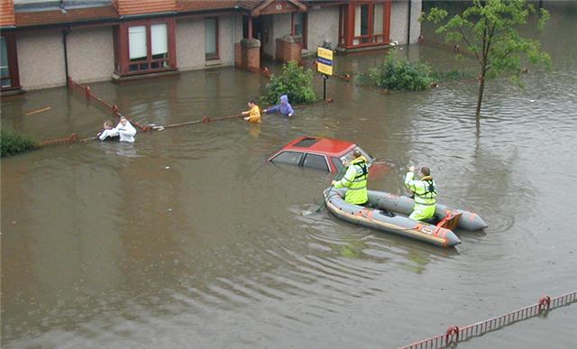
Previous surface water flooding in Glasgow
Previous surface water flooding in Glasgow (© Glasgow City Council)
So what could be done?
Surface water flood forecasting has until recently been regarded as challenging, difficult and often simply not possible. But with recent improvements to surface water flood mapping and ensemble forecasting for convective events, we were keen to meet the challenge head on.
The SFFS set up a project to develop an operational pilot for a 10km by 10km area of Glasgow, and to explore future surface water flood forecasting methods for Scotland, in general. The project was largely funded through Scotland’s Centre of Expertise for Waters (CREW), with the Met Office, CEH Wallingford, Deltares and the James Hutton Institute as partners.
Requirements
To ensure the pilot model would meet the needs of end users we set up a steering group of key responders in Glasgow . The steering group provided an excellent forum for scientists and operational responders to discuss the challenges of surface water flood forecasting from different perspectives, to engage end users with the project at an early stage, and to set realistic expectations for the model output.
The steering group requirements were to focus on the 6 to 24 hour lead time as this is when proactive preparations can be made. Responders wanted guidance on event timings, locations that might be affected, possible impacts and severity and crucially a stand down message when the event is over or the risk level reduces.
From a SFFS perspective, the key goal was to have a fully operational model that combined forecasts and impacts and could be integrated with our existing tools.
The model setup
The pilot model aimed to make the best use of emerging science developments within our existing systems. The methodology built on some of the concepts that the Natural Hazards Partnership have been developing for a national surface water flood forecasting tool, but applied them at a smaller scale, and integrated them with existing SFFS tools.
The model runs eight times a day using forecast rainfall from the Met Office blended ensemble (based on MOGREPS-UK and STEPS), and nowcast ensemble giving rainfall on a 2km grid for the next 24 hours. Each rainfall ensemble is run through the CEH Grid-to-Grid model to convert rainfall to surface runoff based on influences such as antecedent soil wetness, urban cover, terrain and slope.
It is assumed that the surface runoff from Grid-to-Grid is equivalent to the effective rainfall used to produce SEPA’s new pluvial flood maps. This means that for each 1km grid square the most appropriate flood inundation map and impact assessment from a pre-calculated library can be identified. Thresholds were set for people and property impacts (population, utilities, commercial properties and community services) and transport (road and rail), enabling impacts to be compared to our established severity thresholds. Combining this with the probability of exceeding the thresholds allowed the overall surface water flood risk to be identified within our existing flood risk matrix.

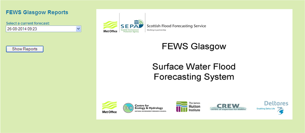
The model output is viewed through web reports developed by Deltares utilising the Flood Estimation and Warning (FEWS) software. The reports showed output for a number of variables of interest over the full 24 hour time period and broken down into 6 hour time steps. FEWS Glasgow allows forecasters to select any forecasts from the past 24 hours, allowing consideration of run to run variability for convective events.
Operational use
The pilot model ran throughout the summer. During the two week period of the Commonwealth Games, an additional SFFS forecasting hydrologist was on duty alongside the national forecaster. They were responsible for producing the Glasgow Daily Surface Water Flood Forecast, which was sent out to responders. An important part of their role was to brief the SEPA Resilience Officer who was advising organisations in the Games Multi Agency Control Centre to ensure SEPA was able to give a consistent and informed message about the flood risk to the Games.
Luckily the weather during the Games was largely fine. However, there were occasions when the additional surface water guidance provided a real benefit to the organisers and responders. This took two forms, firstly enabling the SFFS to advise that although heavy rainfall was forecast in the wider West Central Scotland region, flooding impacts in Glasgow itself were unlikely. Secondly, as was the case on the last weekend of the Games, to provide information on the timing, likely impacts and probability of possible flooding in Glasgow.
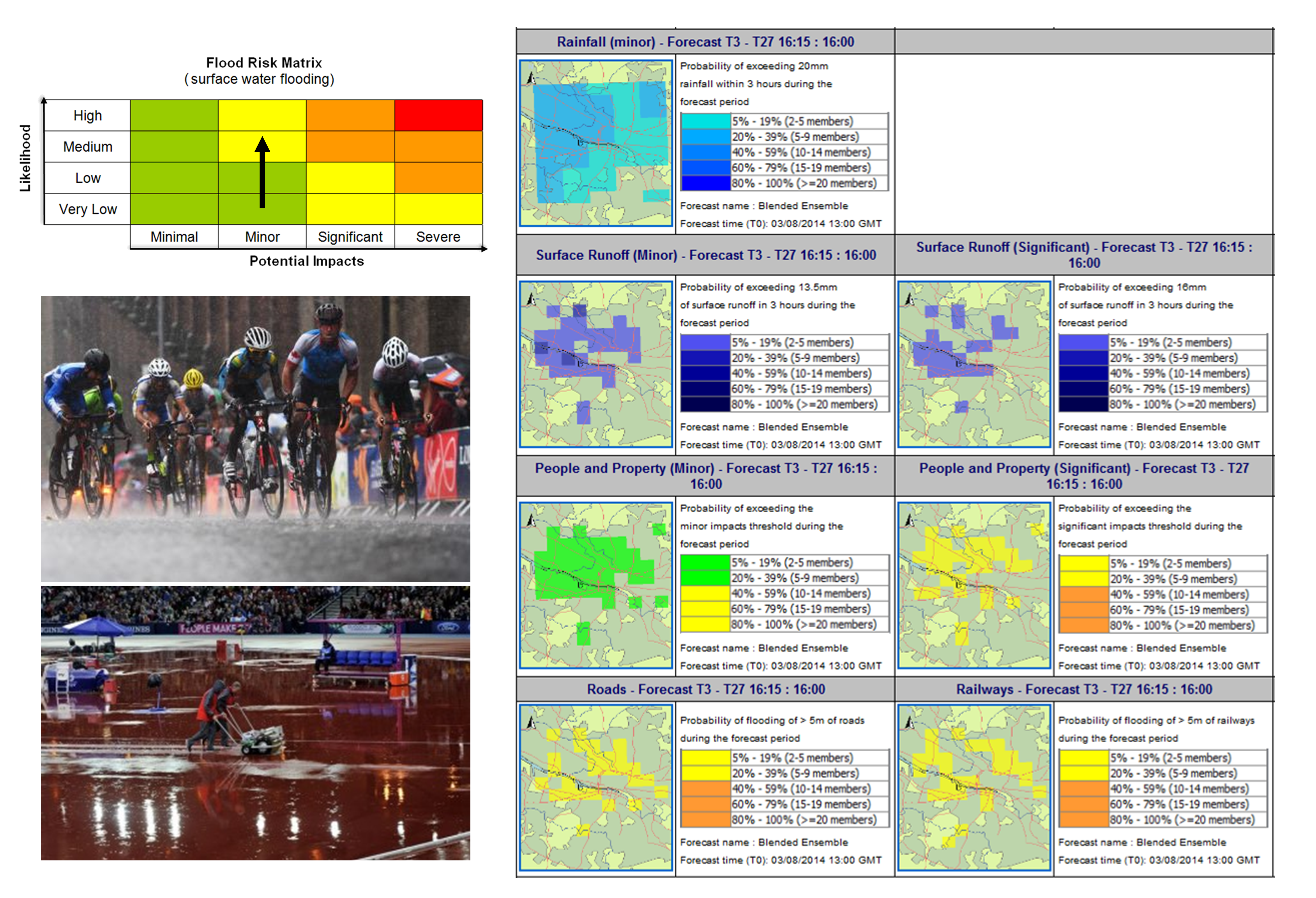
FEWS Glasgow forecasts for afternoon of Sunday 3rd August 2014. Photographs show the conditions at the Games at this time. The risk level had been increased as we got closer to the event as the likelihood increased. There were reports of minor impacts across Glasgow over the weekend. (photo credit www.eveningtimes.co.uk )
FEWS Glasgow forecasts for afternoon of Sunday 3rd August 2014. Photographs show the conditions at the Games at this time. The risk level had been increased as we got closer to the event as the likelihood increased. There were reports of minor impacts across Glasgow over the weekend (photo credit www.eveningtimes.co.uk)
Where next?
The pilot model has shown that it is possible to provide an informed surface water forecasting service, and the feedback received on the service has been positive.
The lesson we learnt during the Games is that the staffing requirements to operate such a service are high due to the need to continually monitor the forecast, given the variability between model runs, and the briefing requirements to help end users understand the uncertainty.
The data volumes involved in rolling out a similar service to the whole of Scotland would also require careful management. Improving capabilities for surface water flood forecasting is one of the core strategic aims of SEPA’s Flood Warning Strategy for 2012 – 2016, and we will use the experience gained in this trial to help improve surface water forecasting for other areas of Scotland in the future.
More details
Further details on the development of this project throughout the year are available on the SFFS blog. There is also a report for the initial review stage of the project. The work was presented at the British Hydrology Society conference (Sep. 2014), and a research paper and final report will be published in due course, so keep an eye out.
October 3, 2014 at 16:58
Very well written description of the pilot forecasting approach. In particular, it’s interesting to see that (a) it is a successful demonstration of a forecaster-over-the-loop approach…that is, forecasters are interpreting outputs of the system rather than modifying the inputs, internal states, and outputs of the system; and (b) that does not mean that forecasters are not still quite busy in the different role of selecting and translating system outputs into services for the EM community and the public.
As for the system itself, I wonder whether the runoff outputs are properly calibrated (ie, unbiased and reliable) relative to the effective rainfall in the SEPA analysis to which they are equated? If not, that would be a potential weakness of the approach, given that it would lead to the wrong selection of inundation analogues.
All in all, though, great post!
October 7, 2014 at 10:48
Thanks for your comments Andy. I agree that it was an interesting opportunity to develop more advisory and briefing skills within the Scottish Flood Forecasting Service. Particularly for surface water forecasting, that’s probably the direction we’re going to need to move towards in the future.
As for whether the runoff outputs are correctly calibrated, we’re going to need some more (bigger) events through the system to test it fully. Initial results seem to indicate it was quite representative to what we were seeing on the ground though.