Crowdsourced data for flood hydrology – Interview with flood chasers in France and Argentina
Contributed by MH Ramos, member of the IRSTEA Columnist Team
A recent paper published in the Journal of Hydrology has drawn my attention: Crowdsourced data for flood hydrology: Feedback from recent citizen science projects in Argentina, France and New Zealand.
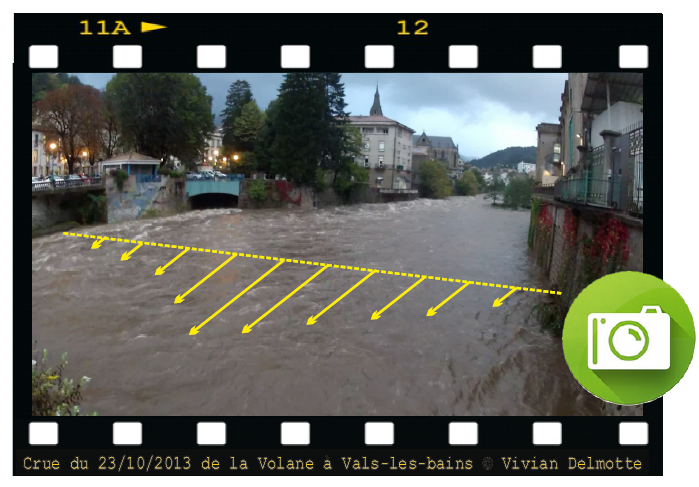
Using videos of flooding rivers to monitor floods (photo: FloodScale Project)
The paper deals with the use of information from social media in applied sciences and operations, with a focus on collecting photos and videos to better assess river flows and to improve flood mapping after severe events. It prompts reflections on the way qualitative and quantitative data can be collected by the public and used in hydrology.
Three initiatives that have been held in France, Argentina and New Zealand are presented in details. From the paper, we learn the motivations and steps of implementation of each project: rules to follow, techniques, photo and video processing software, communication approaches to foster public participation and engagement, etc.
I had the opportunity to ask two questions to the main authors of the paper: Jérôme Le Coz, who is a colleague of mine from Irstea working in the centre located in Lyon, an expert on river hydraulics, morphodynamics and hydrometry, and Antoine Patalano, who I met in Argentina in 2015, when visiting the Universidad Nacional de Córdoba, where he is doing a PhD on large-scale, imaged-based techniques to quantify water surface velocity, under the supervision of Dr. Carlos Marcelo Garcia.
In their answers below, they explain why it is so exciting to chase floods and how it can contribute to enhance flood forecasting systems all over the world.
MHR: What is the most exciting thing about being a flood chaser?
Jérôme: Most field hydrologists are excited about chasing floods to measure them, and so are some non-professional enthusiasts of impressive hydroclimatic phenomena, usually to take beautiful pictures. I think chasing floods, especially flash floods, is similar to chasing storms, tornadoes or eruptions: you rush to be a privileged spectator of a remarkable display of Nature’s power.
Also, with our projects, we have realized that beyond the professionals and non-professional enthusiasts, any involuntary witness of a flood event who has a digital camera in hands can naturally become a flood chaser; it’s an increasingly natural reflex for many people.
Antoine: Being a flood chaser is exciting because you are participating in the characterization of an extreme event of Nature (e.g.: when chasing flash floods, where we have high flow velocities and a huge amount of water), and this by just using a cellphone or a digital camera that you control with your fingers. It’s also very nice to be part of a community that cares about science and environment.
MHR: How can this type of citizen science project contribute to improving real-time flood forecasting?
Antoine: The mountainous rivers of the Córdoba province, in Argentina, are characterized by the occurrence of flash floods. Due to the sudden nature of flash floods, it is very unlikely for a hydrologist to be able to record the peak discharge in river sections of interest. In case it is possible to get in time to the study sites, fast flow velocities and floating river debris can endanger both the instruments and the operators. Flash flood movies recorded by citizens can be processed to estimate river flow velocity and discharges using image velocimetry techniques. In most cases, the data obtained in this type of citizen science project is the only information available to characterize the observed hydrological events. Continuous records of digital cameras could be used in real-time data processing to update a forecasting model, for instance.
Jérôme: Collecting, processing and reviewing crowd-sourced hydrologic data in real time is more difficult than retrospectively. It was not done in our three projects but others were able to make the most of social media and smartphones for this, and populate real-time flood maps, for instance. Retrospective information obtained on flood processes can always be useful for improving real-time hydrologic modelling.
We can also consider the question the other way around: how could real-time flood forecasting help this type of citizen science project ? Some flood chasers already use weather and hydrological forecasts to be there where flooding will occur. Some chasers even manage to anticipate the forecasts, with an amazing intuition (or luck!). The higher the number of flood chasers, the higher the likelihood of obtaining good observations of flood events.
MHR: Thank you, Jérôme and Antoine, for your time and contribution! It is not explicitly said in this interview, but probably well understood by our readers, that care should be taken when doing “flood chasing” to not put your life or the lives of others at risk. Instructions can be found on the webpages of the projects mentioned in the paper (France: FloodScale and Argentina: Cazadores de crecidas).
There are many similar initiatives in other parts of the world. So, for those who are reading this blog post and have some additional thoughts and information on the experience of “flood chasing”, or links to flood videos to share, just leave a comment below.
0 comments