Current floods in central Europe: awareness and monitoring
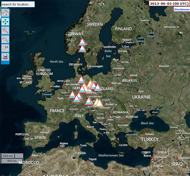 11.06.2013 – Following the severe floods in summer 2002 – and again in spring 2006 – Elbe and Danube and their tributaries are once again facing severe flooding with devastating impact in particular in Germany, the Czech Republic, and Austria. And in the Danube, we now follow the news reports on the situation in Slovakia and Hungary where the flood wave is passing through now.
Within the 10 years since the last flood, much has happened in Europe to improve the preparedness and response to such events. Flood protection measures and flood management plans have been reviewed, flood protection measures implemented, and cooperation between the authorities and countries improved.
On European scale, the European Flood Awareness System (EFAS) has gone operational in 2012 and now contributes to European emergency preparedness through raising awareness and monitoring of the events. EFAS provides information for the relevant national authorities and informs the European Commission’s Emergency Response Centre (ERC) in advance with overviews of potential flooding. EFAS represents the early warning component of the COPERNICUS Emergency Management Service of the European Commission, which also includes a rapid mapping component once the floods have developed. On request of the countries, satellite imagery can be obtained and the flood extents provided. Reference maps and flood extent maps delivered by the EMS are available at http://emergency.copernicus.eu.
Early flood warning systems are one of the most important tools to reduce the impacts of floods. The JRC has been developing EFAS since 2002, in close collaboration with other Commission services as well as national hydrological and meteorological services, and other research institutes. EFAS flood forecasts are generated coupling a spatially distributed hydrological model on a European scale with various high-resolution, deterministic and probabilistic medium-range weather forecasts from the European Centre for Medium-Range Weather Forecasts (ECMWF), the German Weather service, and the COSMO consortium, thus promoting ensemble prediction and multiple-input forecasts.
Since September 2012, EFAS is fully operational under the umbrella of the COPERNICUS Emergency Management Service (http://copernicus.eu/). It is run by several consortia: the EFAS computations and web services are executed and hosted by ECMWF (UK);the analysis of EFAS forecasts and the dissemination of EFAS flood alerts are carried out by the Swedish Meteorological and Hydrological Institute (SE), Rijkswaterstaat (NL) and Slovak Hydro-Meteorological Institute (SK) and the hydrological data collection is accomplished by the Andalusian Regional Ministry of Agriculture, Fishing and Environment (ES) in cooperation with private company ELIMCO (ES). The overall project management remains with the European Commission.
Exploring the benefit of ensemble prediction for flood forecasting on different scales and studying how to visualise the results in a way that better decisions can be made, has naturally linked the EFAS research and development directly to the HEPEX initiative.
The terrible news of at least 15 casualties and pictures showing vast areas of land under water and villages where only roof tops are visible amongst the flood waters, illustrate to us that despite the efforts in flood prevention and preparedness and improved collaborations between meteorologists and hydrologists and scientists and operators, there is still a lot for the HEPEX community to do.
June 11, 2013 at 17:21
SMOS maps record soil water before flood (ESA web site)
http://www.esa.int/Our_Activities/Observing_the_Earth/The_Living_Planet_Programme/Earth_Explorers/SMOS/SMOS_maps_record_soil_water_before_flood
June 26, 2013 at 05:17
This is a great accomplishment. It would be exciting to see a similar capability extended to North America (or globally…), including the necessary outreach work to address the continuing, and regrettable casualties from such events.
June 26, 2013 at 10:19
Indeed – following the experience from EFAS, the JRC and the European Centre for Medium-Range Weather Forecast (ECMWF) have explored the possibility to run a simplified global flood awareness system -simplified in the sense, that we make use of the land-surface scheme outputs from the NWP and couple this with a river routing scheme. This now runs globally in experimental mode. While obtaining encouraging results, it is also clear that such a system must be developed within a global community as there are too many avenues to explore and too many issues to be addressed that require local and regional knowledge and expertise.
The JRC has initiated a Global Floods Group where scientists, practioners and end-users come together once a year to discuss advances in global flood detection, and flood forecasting. Browse here for the results of the last workshop : http://portal.gdacs.org/Expertworkinggroups/GlobalFloodWorkingGroup/2013Workshop/tabid/247/language/en-US/Default.aspx and look out here at the HEPEX site for the announcement of the next workshop which will be held in Europe again!
June 27, 2013 at 23:43
Next workshop will be in Reading and we will announce details shortly