Operational HEPS systems around the globe
Is there a hydrological ensemble prediction system implemented (or in pre-operational phase) in your catchment, region or country? Tell us more about it!
PLEASE NOTE: We will regularly update the table below using the comments
Cloke et al. (2009) p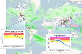 resented various operational systems, including references to their development studies and communication platforms. Since this publication, many other platforms have become available or are running in a pre-operational mode.
With this blog post we want to put together information about all these systems!
We hope this will offer HEPS users and developers an opportunity to share knowledge and experience. Leave a comment with information about the system(s) running in your catchment, region or country, or just give your opinion/suggestion about this initiative. We will be glad to add it to this post.
Forecast centres with operational or pre-operational HEPS systems
(in no particular order)
|
Forecast centre name |
Provider |
Domain |
Web address (if there is no address, add a picture!) |
| European Flood Awareness System (EFAS) | European Commission (Copernicus) | Europe | www.efas.eu |
| Global Flood Awareness System (GloFAS) | European Commission (JRC)/ECMWF | Global | www.efas.eu Alfieri et al., 2013 |
| Flood-PRObabilistic Operational Forecasting System (FLOOD-PROOFS) | Compagnia Valdostana delle Acque (CVA) S.p.a | Valle d’Aosta (Northern Italy) | Laiolo et al. and here |
| Joint Flood Forecasting System | Environment Agency / Met Office | UK | http://www.ffc-environment-agency.metoffice.gov.uk/ |
| Climate Forecast Applications in Bangladesh (CFAB) | Consortium of Bangladeshi and international organizations and institutes | Bangladesh | http://cfab.eas.gatech.edu/cfab/cfab.html |
| EDF-EPS | EDF | France and Rhine | http://www.lthe.fr/PagePerso//chardon/doc/chardon_EGU_2012.pdf) (also see comments for details) |
| Hydrologic Ensemble Forecasting Service (HEFS) | US National Weather Service | United States | Currently in development for US-wide usage — an experimental operational implementation showing real-time forecasts for locations in California and Nevada is accessible through the CN River Forecast Center |
| Meteorological Model Ensemble River Forecasts (MMEFS) | US National Weather Service | United States | Recently declared ‘operational’ — for four NWS river forecast centers in the eastern US: real-time forecasts are accessible here |
| Emilia Romagna Warning operational center | Emilia Romagna Regional Agency Prevention and Environment | Emilia Romagna Italy – Po basin (Northern italy) | Please see comment attached to this blog |
| French Hydro-meteorological Ensemble Prediction System | Meteo France / French Service for Flood Prediction (SCHAPI) | France | Thirel et al (2010a, 2010b) and poster EGU 2013 – also see comments to blog |
| Watershed simulation and forecasting system (WSFS) | Finnish Environment Institute (SYKE) | Finland | http://www.environment.fi/waterforecast, http://www.ymparisto.fi |
| Swedish flood-forecasting system | Swedish Meteorological and Hydrological Institute (SMHI) | Sweden | http://www.smhi.se, Arheimer et al. (2011) |
| Swiss FEWS-HBV, FEWS-PREVAH, FEWS-WaSiM-ETH | Switzerland | Swiss Rivers: Rhine up to Basel, Linth and Sihl,the Emme,the Rhone. | http://www.hydrodaten.admin.ch/en/index.html#vorhersagen (see blog comment for more details) |
| WSL Flood Forecasting | WSL | Sihl, Ticino, Linth and Thur | http://hydro.slf.ch/sihl/chysghl/ (see blog comment for more details) |
| 3Tier | 3Tier | Various | http://www.3tier.com/en/package_detail/powersight-basin-monitor-forecasting/ |
| BoM | BoM | Australia | http://www.bom.gov.au/water/ssf/index.shtml |
| Scottish Flood Forecasting Service | SEPA and Met Office | Scotland | http://www.floodforecastingservice.net/ |
| BfG-Forecasts for the German Waterways | Federal Institute of Hydrology (BfG) | Germany | www.bafg.de/vorhersage |
Help HEPEX to complete the list and become a co-author of this post
Co-authors: Pappenberger, F., Stephens, L., van Andel, S.J., Verkade, J.S., Ramos, M.H., Alfieri, L., Brown, J.D., Zappa, M., Ricciardi, G., Wood, A., Pagano, T., Marty, R., Collischonn, W., Le Lay, M., Brochero, D., Cranston, M., Meissner, D.
May 30, 2013 at 17:40
Few more here:
6. Operational Hydro-meteorological Ensemble Prediction System
Meteo France / French Service for Flood Prediction (SCHAPI)
France
Thirel et al (2010a, 2010b) and poster EGU 2013
7. Watershed simulation and forecasting system (WSFS)
Finnish Environment Institute (SYKE)
Finland
http://www.environment.fi/waterforecast, http://www.ymparisto.fi
8. Swedish flood-forecasting system
Swedish Meteorological and Hydrological Institute (SMHI)
Sweden
http://www.smhi.se, Arheimer et al. (2011)
June 7, 2013 at 18:00
I will complete what Lorenzo said in 6).
The french administrative system includes 1 central service (SCHAPI) and (currently) 22 regional services (including mine over the Loire catchment). France is thus divided according to an hydrological point of view (see Tanguy et al, 2005 doi:10.1051/lhb:200502005).
* The central french service manages the global coherence of hydrological predictions and publish them on a map (at least two per day, at 10h and 16h local time) : http://www.vigicrues.ecologie.gouv.fr/index.php Forecasted hydrographs are not published. Only a level of “warning” is given (green, yellow, orange and red) according to the forecasted maximum level at streamflow stations and local impact of flood.
* Hydrological predictions are made in the regional services and not all use the global hydrological prediction system based on Safran-Isba-Modcou system (cf. Thirel 2010a,b). According to the catchment, to the regional service, the flood generating process, hydrological prediction systems may :
– use (one or more) deterministic meteorological predictions as flood guidance
– use (one or more) deterministic meteorological predictions as input of hydrological model (e.g. GRP, see Berthet et al, 2009 doi:10.5194/hess-13-819-2009)
– complete this system by hydraulic or statistical models in order to take into account the downward flood propagation
– some of regional services use probabilistic precipitations forecasts provided by an alternative system based on analog sorting approach (see Marty et al, 2012, http://dx.doi.org/10.1175/JAMC-D-11-011.1)
You can see that there is as many operational hydrological prediction systems in France as regional services.
June 13, 2013 at 10:30
Are they also probabilistic systems in the regions?
June 14, 2013 at 08:15
I will give some details only on the hydrological prediction system developed in the Loire-Cher-Indre regional service. I don’t know the other systems because i just arrived in the SCHAPI-SPC network.
Hydrological models are generally applied on small upper basins. Several meteorological scenarios may be used as inputs. But the hydrological forecasting expert select only one scenario to propagate downward through hydraulic or statistical models. Downward, only one scenario is elaborated and propagated farther downward. So we cannot say that it is a probabilistic system.
The concept of uncertainty is quite new in the administrative system. I think that developing probabilistic systems is the next step. Without removing the expertise of hydrological forecasters.
June 3, 2013 at 00:18
The U.S. National Weather Service’s Hydrologic Ensemble Forecast Service (HEFS).
There’s an overview paper forthcoming in BAMS (Demargne et al. 2013) and several papers on the verification of hindcasts from this operational system that are in preparation. The report from the first phase of verification is available here:
http://www.nws.noaa.gov/oh/hrl/hsmb/docs/hep/publications_presentations/Contract_2012-04-HEFS_Deliverable_02_Phase_I_report_FINAL.pdf
The system is based on work published over many years. Notably:
Wu, L., Seo, D-J, Demargne, J. and Brown, J.D., Cong, S. and Schaake, J. (2011) Generation of ensemble precipitation forecasts from single-valued quantitative precipitation forecasts for hydrologic ensemble prediction. Journal of Hydrology, 399(3-4), 281-298.
Seo, D-J., Demargne, J., Wu, L., Liu, Y., Brown, J. D., Regonda, S. and Lee, H. 2010. Hydrologic Ensemble Prediction for Risk-Based Water Resources Management and Hazard Mitigation, 4th Federal Interagency Hydrologic Modeling Conference, June 27-July 1, 2010, Las Vegas, NV.
Brown, J.D., Demargne, J., Seo, D-J. and Liu, Y. (2010). The Ensemble Verification System (EVS): a software tool for verifying ensemble forecasts of hydrometeorological and hydrologic variables at discrete locations. Environmental Modelling and Software, 25(7), 854-872.
Schaake, J.C., Demargne, J., Hartman, R., Mullusky, M., Welles, E., Wu, L., Herr, H.,
Fan, X., Seo, D.-J. (2007). Precipitation and temperature ensemble forecasts from
single-value forecasts. Hydrology and Earth System Sciences Discussions 4,
655–717
Seo, D.-J., Herr, H. D., and Schaake, J. C. (2006). A statistical post-processor for accounting of hydrologic uncertainty in short-range ensemble streamflow prediction, Hydrol. Earth Syst. Sci. Discuss., 3, 1987-2035, doi:10.5194/hessd-3-1987-2006, 2006.
June 5, 2013 at 01:39
In addition to HEFS the US has the Meteorological Model Ensemble River Forecasts (MMEFS) http://www.erh.noaa.gov/mmefs/
The product description is at http://www.erh.noaa.gov/mmefs/Help/PDD_operational_draft.pdf
A powerpoint at
http://www.inafsm.net/conference/2012/docs/pres12/b3f1_mmefs.pdf
James would know for sure but I think one of the main differences between HEFS and MMEFS is that HEFS considers parameter uncertainty in the rainfall-runoff model.
June 5, 2013 at 01:41
Of course, the NWS also has their standard ESP/AHPS system that has been running for a number of years. This is playing more and more of a central role in the seasonal water supply forecasting.
June 9, 2013 at 23:54
An overview on some differences between MMEFS and HEFS can be found here: http://hydro.bnu.edu.cn/HEPEX_ppt/2012.10.22/Wood_NWS_ens_fcst_HEPEX12.pdf
In brief, the major differences between HEFS and MMEFS include:
a) HEFS is a fully-specified service that includes elements such as pre- and post-processing of hydrologic prediction inputs and outputs, verification and product generation, and eventually, it is hoped, data assimilation
b) HEFS makes use of CFS and GEFS ensemble mean predictions to statistically generate calibrated meteorological forcing inputs for the hydrology models at lead times of up to 10 months. Results are considered quantitative.
c) MMEFS does not attempt to include all of the elements of a conceptual HEPS, but does use full ensemble grid outputs from GFS, SREF and NAEFS that are just interpolated (not calibrated) to the watershed centroid. Results are considered qualitative.
d) MMEFS design and development was led at the grassroots level by River Forecasting Center personnel; whereas HEFS was designed by members of the NWS Hydrology Lab.
June 12, 2013 at 17:24
As Andy mentioned, the primary difference between the HEFS and the MMEFS concerns the treatment of uncertainties (and in the level of sophistication of that treatment). The HEFS is an end-to-end hydrologic ensemble forecasting system that factors the total uncertainty into a series of individual sources (applying bias-corrections to the forcing and streamflow). The MMEFS simply takes the raw forcing members and propagates these through the hydrologic models, without any bias correction of the forcing or streamflow.
Currently, the HEFS models the total hydrologic uncertainty through statistical post-processing; there is no separate accounting for the uncertainties contributed by the hydrologic initial conditions, model structures or parameters etc., but there is a clear framework to allow for this in future (e.g. various flavors of DA are under developed).
The HEFS will essentially replace ESP for long-range forecasting/hindcasting and provides a new capability for short-to-medium range forecasting/hindcasting. The MMEFS focuses on the short-to-medium range and was more of a “stop gap” measure, pioneered by several RFCs, and developed as the HEFS was in progress, although there are some aspects of the MMEFS that remain appealing (in terms of simplicity).
June 3, 2013 at 10:01
In Switzerland there are since 2007 several HEPS application.
For authorities (http://www.hydrodaten.admin.ch/en/index.html#vorhersagen):
The FEWS-HBV simulation for the Rhine up to Basel is operational since 2007.
The FEWS-PREVAH implementation for Linth and Sihl is opertational since 2011.
The FEWS-WaSiM-ETH implementation for the Emme is operational since 2011.
The FEWS-WaSiM-ETH implementation for the Rhone is operational since 2013.
Further applications are pre-operational or in developement (Alpine Rhine, Ticino)
For Research:
We have our own HEPS applications since 2007 (http://hydro.slf.ch/sihl/chysghl/)
These includes:
– HEPS with probabilistic NWP for the Sihl (7 gauges), Ticino (15 gauges), Linth (2 gauges) and Thur
– HEPS with probabilistic weather radar QPE, Ticino (7 gauges)
– A probabilistic system for early recognition of low-flows is pre-operational (lead time of one month)
Related publications:
Liechti K, Panziera L, Germann U, Zappa M. Flash flood early warning using weather radar data: from nowcasting towards forecasting. Submitted to Hydrol. Earth Syst. Sci.
Fundel F, Joerg-Hess S, Zappa M. 2013. Monthly hydrometeorological ensemble prediction of streamflow droughts and corresponding drought indices. Hydrol. Earth Syst. Sci., 395-407, doi:10.5194/hess-17-395-2013.
Liechti K, Zappa M, Fundel F, Germann U. 2013. Probabilistic evaluation of ensemble discharge nowcasts in two nested Alpine basins prone to flash floods. Hydrological processes. 27: 5-17. doi:/10.1002/hyp.9458
Zappa M, Fundel F, Jaun S. 2013. A “Peak-Flow Box” Approach for Supporting Interpretation and Evaluation of Operational Ensemble Flood Forecasts. Hydrological processes. 27: 117-131. doi:/10.1002/hyp.9521
Fundel F, Zappa M. 2011. Hydrological Ensemble Forecasting in Mesoscale Catchments: Sensitivity to Initial Conditions and Value of Reforecasts. Water Resour. Res., 47, W09520, doi:10.1029/2010WR009996.
Addor N, Jaun S, Fundel F, Zappa M. 2011. An operational hydrological ensemble prediction system for the city of Zurich (Switzerland): skill, case studies and scenarios, Hydrol. Earth Syst. Sci., 15, 2327-2347, doi:10.5194/hess-15-2327-2011.
Zappa M, Jaun S, Germann U, Walser A, Fundel F. 2011. Superposition of three sources of uncertainties in operational flood forecasting chains. Atmospheric Research. . Thematic Issue on COST731. Volume 100, Issues 2-3, 246-262. doi:10.1016/j.atmosres.2010.12.005
Rossa A, Liechti K, Zappa M, Bruen M, Germann U, Haase G, Keil C, Krahe P. 2011. The COST 731 action: a review on uncertainty propagation in advanced hydro-meteorological forecast systems. Atmospheric Research. . Thematic Issue on COST731. Volume 100, Issues 2-3, 150-167. doi:10.1016/j.atmosres.2010.11.016
Romang H, Zappa M, Hilker N, Gerber M, Dufour F, Frede V, Bérod D, Oplatka M, Rhyner J. 2011. IFKIS-Hydro – Early Warning and Information System for Floods and Debris Flows. Natural Hazards, 56: 509-527. doi: 10.1007/s11069-010-9507-8
Zappa M, Beven KJ, Bruen M, Cofino A, Kok K, Martin E, Nurmi P, Orfila B, Roulin E, Schröter K,Seed A, Stzurc J, Vehviläinen B, Germann U, Rossa A. 2010. Propagation of uncertainty from observing systems and NWP into hydrological models: COST-731 Working Group 2. Atmospheric Science Letters, 2: 83-91. doi:10.1002/asl.248
Bruen M, Krahe P, Zappa M, Olsson J, Vehvilainen B, Kok K, Daamen K. 2010. Visualising flood forecasting uncertainty: some current European EPS platforms – COST731 Working Group 3. Atmospheric Science Letters, 2: 92-99. doi:10.1002/asl.258
Ranzi R, Bacchi B, Ceppi A, Cislaghi M, Ehret U, Jaun S, Marx A, Hegg C, Zappa M. 2009. Real-time demonstration of hydrological ensemble forecasts in MAP D-PHASE. La-Houille-Blanche. 5. 95-103. doi:10.1051/lhb/2009061
Rotach MW, Ambrosetti P, Ament F, Appenzeller C, Arpagaus M, Bauer HS, Behrendt A, Bouttier F, Buzzi A, Corrazza M, Davolio S, Denhard M, Dorninger M, Fontannaz L, Frick J, Fundel F, Germann U, Gorgas T, Hegg C, Hering A, Keil C, Liniger MA, Marsigli C, McTaggart-Cowan R, Montani A, Mylne K, Ranzi R, Richard E, Rossa A, Santos-Muñoz D, Schär C, Seity Y, Staudinger M, Stoll M, Volkert H, Walser A, Wang Y, Wulfmeyer V, Zappa M. 2009. Supplement to MAP D-PHASE: Real-Time Demonstration of Weather Forecast Quality in the Alpine Region: Additional Applications of the D-Phase Datasets. Bulletin of the American Meteorological Society. 90. Pages s28-s32. doi:10.1175/2009BAMS2776.2
Germann U, Berenguer M, Sempere-Torres D, Zappa M. 2009. REAL – Ensemble radar precipitation for hydrology in a mountanious region. Quarterly Journal of the Royal Meteorological Society. 135: 445–456. doi:/10.1002/qj.375
Zappa M, Rotach MW, Arpagaus M, Dorninger M, Hegg C, Montani A, Ranzi R, Ament F, Germann U, Grossi G, Jaun S, Rossa A, Vogt S, Walser A, Wehrhan J, Wunram C. 2008. MAP D-PHASE: Real-time demonstration of hydrological ensemble prediction systems. Atmospheric Science Letters, 2: 80-87. DOI: 10.1002/asl.183.
June 4, 2013 at 20:39
pre operational HEPS
input: COSMO LEPS, imported twice a day
sites: Po main river reach and Emilia Romagna tributaries ( catchment area from 600 km2 to 41.000 km2)
hydrologic hydraulic: Mike 11 nam-hd, Topkapi Sobek, HEC hms- ras
lead time: from 72 h to 120 hours
indicator: water level [m]
Correction: h (m) [fixed]
for each section: three hydrometric thresholds L1, L2 L3
results for each run and each site:
Maximum level range [m]
Median of maximum levels [m]
Time at maximum level range [hour]
and for each threshold
Number of members exceeding threshold
Range of time at threshold exceeding
Range of threshold exceeding duration
for each site and Group of runs persistence analysis
June 5, 2013 at 01:54
Not sure if you want to include the private sector in your list but there are consulting firms like 3Tier (http://www.3tier.com/en/package_detail/powersight-basin-monitor-forecasting/).
In Switzerland E-Dric (www.swissrivers.ch) provide probabilistic forecasts but I think they are deterministic forecasts with some kind of statistical post-processing, not a proper ensemble forecasting system. Cool nonetheless.
June 10, 2013 at 09:22
Agree, they have cool stuff.
They use of COSMO-LEPS for selected users
June 5, 2013 at 02:16
Meanwhile, in Australia…
Seasonal streamflow forecasts (http://www.bom.gov.au/water/ssf/index.shtml) are made with a statistical technique. The Bayesian Joint Probability (BJP) method involves MCMC sampling of parameters and therefore produces ensemble outputs (hundreds to thousands I believe?) but this is just to get smooth probabilistic distributions. It’s not a traditional ensemble forecasting method in the sense of using a dynamical rainfall-runoff model; also, the ensembles themselves never make it to the users (except a select few registered/subscription users?). An interesting feature of this method is that even though the method is statistical, the ensembles are spatially consistent (i.e. individual ensemble members for neighboring forecast points are physically plausible, considering the spatial covariance from one point to the next… This is useful if you’re a reservoir operator managing several points simultaneously.)
Very short-range flood forecasting is deterministic and will likely remain so in the near future. The hydrologist may run a few canned scenarios through the model to get an idea of sensitivity (e.g. 0 rain, 5 mm/hr for 1 hour, 10 mm/hr etc). The sensitivity tests are manually run and are not always done.
Short-term forecasts (1-10 days ahead) are still in pre-operational mode.
http://www.bom.gov.au/water/about/waterResearch/document/project4.1.pdf
For now the forecasts are deterministic with statistical post-processing to make them probabilistic but in the next year or so it’ll be using ensemble precipitation forcings. Deterministic rainfall forecasts (NWP output) are converted to ensembles using the BJP method mentioned above combined with the Schaake Shuffle. This also does bias correction. The ensembles are then forced into a rainfall-runoff model.
June 12, 2013 at 15:56
Ensemble forecasting operationalization in Brazilian River Basins
In Brazil, operational flood warning systems are rare, and often based on simplified river routing or linear transfer function models. However, a large number of global and regional meteorological models operationally run covering most of the country, and forecasts of those models are available for recent years.
In our research group at Instituto de Pesquisas Hidráulicas (IPH) of Universidade Federal do Rio Grande do Sul (UFRGS) we developed a forecasting system using the MGB-IPH hydrological model, with a simple empirical state updating method. The system platform is fully coupled to a GIS tool (Mapwindow GIS), which facilitates the system operation and interpretation of results.
This forecasting system was tested, however using only deterministic precipitation forecasts, in two large scale river basins in Brazil: the São Francisco River upstream of Pirapora (60 thousand km2) and the Tocantins River (300 thousand km2). In parallel with the forecasting system testing, we conducted experiments of short term ensemble flood forecasting in the Paraopeba River basin (12 thousand km2), located in Southeastern Brazil, inside the São Francisco River basin.
Flood forecasts experiments were performed for three rainy seasons (austral summer) between 2008-2011. The results for predictions of dichotomous events, which mean exceeding or not flood warning thresholds, showed that the upper quantiles of the ensemble (e.g. 80th and 90th quantiles) over performed the deterministic forecast and even the ensemble mean. In most cases we observed an increase in the proportion of correctly forecasted events while keeping false alarm rates at low levels. This benefit was generally higher for higher flow thresholds and for longer lead times, which are the most important situations for flood impact mitigation. Results obtained in the Paraopeba River motivated the incorporation of NWP ensemble outputs in the forecasting system to make probabilistic predictions.
Right now we are working on the system upgrade to include ensemble forecasts from two centers: (i) Brazilian Centro de Previsão do Tempo e Estudos Climáticos (CPTEC-INPE) that produces and distributes ensemble forecasts with 6 members from the ETA model (http://previsaonumerica.cptec.inpe.br/); and (ii) The ensemble products from ESRL/PSD GEFS Reforecast Version 2 (http://www.esrl.noaa.gov/psd/forecasts/reforecast2/), which dataset consists of an 11-member ensemble of forecasts, produced every day from 00 UTC initial conditions from Dec 1984 to present.
We are also searching for others data centers that provide access to ensemble data to include in the system.
We expect that the first system version will be fully operational until the end of August, 2013.
Fernando Mainardi Fan (Federal University of Rio Grande do Sul)
Walter Collischonn (Federal University of Rio Grande do Sul)
Vinicius Alencar Siqueira (Federal University of Rio Grande do Sul)
Adalberto Meller (National Water Agency)
June 14, 2013 at 12:16
Hi Folks. We’re hoping to update our service and science pages shortly, but in the meantime it would be good to our forecasting centre listed:
Centre Name: Scottish Flood Forecasting Service
Provider: SEPA and Met Office
Domain: Scotland
Web Address: sepa.org.uk/flooding/flood_forecasting_service.aspx
June 14, 2013 at 17:38
Thanks. Some more reading here on the latest developments with the Scottish Flood Forecasting Service:
The use of deterministic and probabilistic forecasting in countrywide flood guidance in Scotland
BHS Eleventh National Symposium, Hydrology for a changing world, Dundee 2012
This paper presents operational application of a physical-conceptual distributed hydrological model on a countrywide basis across Scotland. Grid-to-Grid principally runs in deterministic mode and employs radar and raingauge estimates of rainfall together with weather model predictions to produce forecast river flows, as gridded time-series at a resolution of 1 km and for up to five days ahead. Read the full paper
Countrywide flood forecasting in Scotland: challenges for hydrometeorological model uncertainty and prediction
Weather Radar and Hydrology, IAHS Publ. 351, 2012
The Scottish Flood Forecasting Service, a new partnership between the Met Office and the Scottish Environment Protection Agency, aims to make best use of weather and river forecasting expertise in providing improved flood resilience and vigilance for emergency responders across Scotland. Read the abstract
June 21, 2013 at 17:26
A few words on the EDF (French Producer of Energy) Ensemble forecasting chain.
We performs daily operational hydro-meteorological forecasts on about 120 watersheds in France. We developped our hydro-meteorological ensemble prediction system in 2010. It is now daily used to produce short to medium range operational streamflow forecasts on about 50 catchements.
Main characteristics:
– Inputs: daily ECMWF-EPS, combined with an analog sorting approach to ensure reliable ensemble meteorological predictions on each catchment.
– Lead-time: up to 14 days
– Hydrological model: the EDF MORDOR conceptual model
– Streamflow post-processing: a statistical uncertainty dressing method
A particularity is that the forecasters may expertise each part of the forecasting chain: they can deform the rainfall or temperature scenarios (based on other NWP models for example) as well as the streamflow scenarios before diffusing forecasts.
June 25, 2013 at 18:41
I think it is pertinent to emphasize the Canadian program MESH (http://www.usask.ca/hydrology/MESH.php) to facilitate coupling between models representing different components of the earth system. An example of such system, as a pre-operational Hydrological Ensemble Prediction System, can be found in:
Pietroniro, A., Fortin, V., Kouwen, N., Neal, C., Turcotte, R., Davison, B., Verseghy, D., Soulis, E. D., Caldwell, R., Evora, N., and Pellerin, P.: Development of the MESH modelling system for hydrological ensemble forecasting of the Laurentian Great Lakes at the regional scale, Hydrol. Earth Syst. Sci., 11, 1279-1294, doi:10.5194/hess-11-1279-2007, 2007.
Forecast centre name: Canadian Meteorological Center
Provider: Environment Canada
Domain: Canada
Web address: ec.gc.ca
July 9, 2013 at 14:09
Hi. Thanks for pulling together an excellent reference point for HEPS systems around the globe. Could you change the Scotland entry website to http://www.floodforecastingservice.net – this include more science information. Many thanks, Mike.
July 9, 2013 at 14:24
Changed accordingly. Nice portal, by the way.
May 20, 2014 at 13:50
Hi to all, I signal an application of FLOOD-PROOFS (already present in tha table) in the Liguria Region, Italy. In this case both single site and multi-catchment approach is operationally used.
Forecast centre name: FLOOD-PROOFS Liguria
Provider: Hydro-Meteorological Forecast Center of Liguria Region, Italy
Domain: Liguria Region, Italy
Web address : http://journals.ametsoc.org/doi/abs/10.1175/JHM-D-10-05022.1