Memories of the Taquari River
Contributed by Sofia Royer Moraes, PhD candidate UFRGS, Brazil
The study and understanding of the natural dynamics of rivers has always brought a gleam to my eyes, since its application is important to society, especially for those most susceptible to it. I am currently studying extreme floodings, that is, rarer events, which also have the greatest impact on society, both for measures to be taken in order to reduce economic damage in an upcoming event and the impact on people’s memories.
Over time, it is natural to keep these natural events locked away in the most distant drawers and, little by little, not to treat the matter with the relevance it deserves. Often we return to the matter only when a more extreme event happens again. So, then, what to do about it? How can we act to mitigate and provide the answers that everyone is looking for in a short time? Who to blame for the socioeconomic errors and impacts caused by extreme flooding?
We realize over time that there is no right or wrong, no precise answer, no guilty ones to blame. We need to start acting, acting with science, with simple actions that will sensitize individuals from all social classes; actions that will reflect these actions within their families, communities and then, certainly, time will bring the answers in terms of society and more effective actions.
The municipality of Lajeado, with its approximately 78,000 inhabitants, located in the State of Rio Grande do Sul, the southernmost region of Brazil, has its history of urbanization closely linked to the Taquari River, which was the main means of transportation and source of livelihood at the time of the European colonization. Geographically speaking, Lajeado is located in a low portion of the Taquari Antas River Basin and, with some frequency, suffers from the impacts of its anthropization in the flooded areas of the Taquari River.
The city grew on the banks of the Taquari River, a source of water for the population and also an inspiring and necessary source of many scientific studies, which, among others, helped the local community to gain resilience to face floods, natural processes in the region.
In a recent effort to search for historical information on the highest level of flooding recorded in Lajeado and the hydrographic region, known as the 1941 flood, we found many images of historical floods, even before that time, as shown below: records from 1893, 1911, 1926 and 1941.
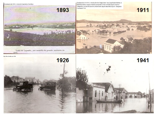
Major historic floods in Lajeado (RS), Brazil
Recently, on 9 July 2020, we had another record to add to the history of the Taquari River. After a few months with a record of water scarcity, a flood, the fourth largest recorded in the last 64 years took place.
The video below, by Leonardo Feldmann, captures well the extent of the flooding:
At first, the community was furious; decision makers did not know what to do; high socioeconomic impacts were observed. Then, flood recover started; data is being recorded and analyzed and small steps begin to be taken.
The impact of the July 2020 flood showed the community of Lajeado that they must always be attentive. The river is dynamic and floods will occur again, even maybe more extreme ones. To guarantee the memory of the community, some initiatives have been taken, others are still being planned, but the most important is that the first steps are being taken, like the one shown in the image below: a ruler installed by ACIL (The Commercial and Industrial Association of Lajeado), which also marks the four historic floods recorded, in order to remember the floods that most impacted the municipality.
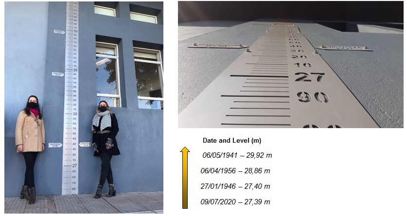
Ruler installed by ACIL. In the center, the ruler, with the demarcations of the 4 largest events recorded in Lajeado. On the right to the rules, the architect who designed the ruler (Kátia Eckert) and, on the right, myself, the author of this post, Sofia Royer Moraes, who contributed with the estimation of the flood levels and is happy with this action taken and the inauguration of the ruler on August 21, 2020!
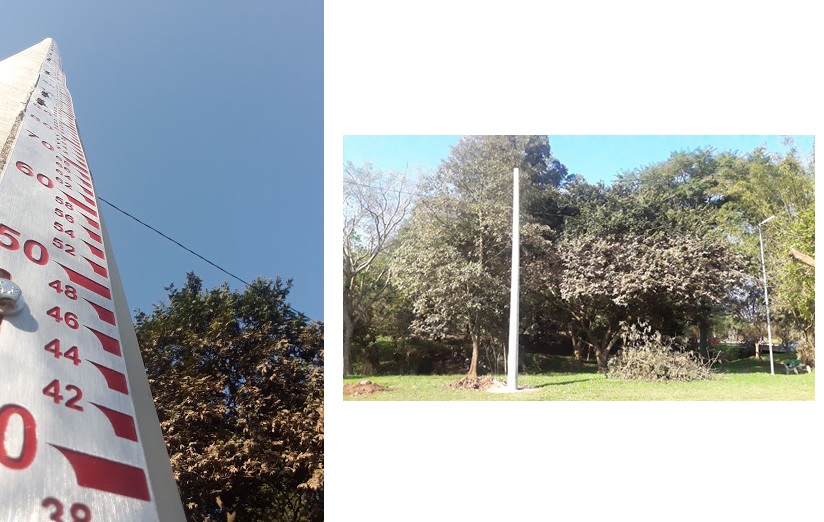
This other ruler was installed by the city hall, in Parque dos Dick, a common area for flooding and leisure in Lajeado. In the image above, the flood trail of July 9, 2020 can still be seen in the vegetation (photo August 26, 2020).
It is gratifying to see these actions taking place. They will certainly contribute to enhnace resilience of societies that committed to water resources and risk management.
For now, the Taquari River continues to keep good memories on its journey.
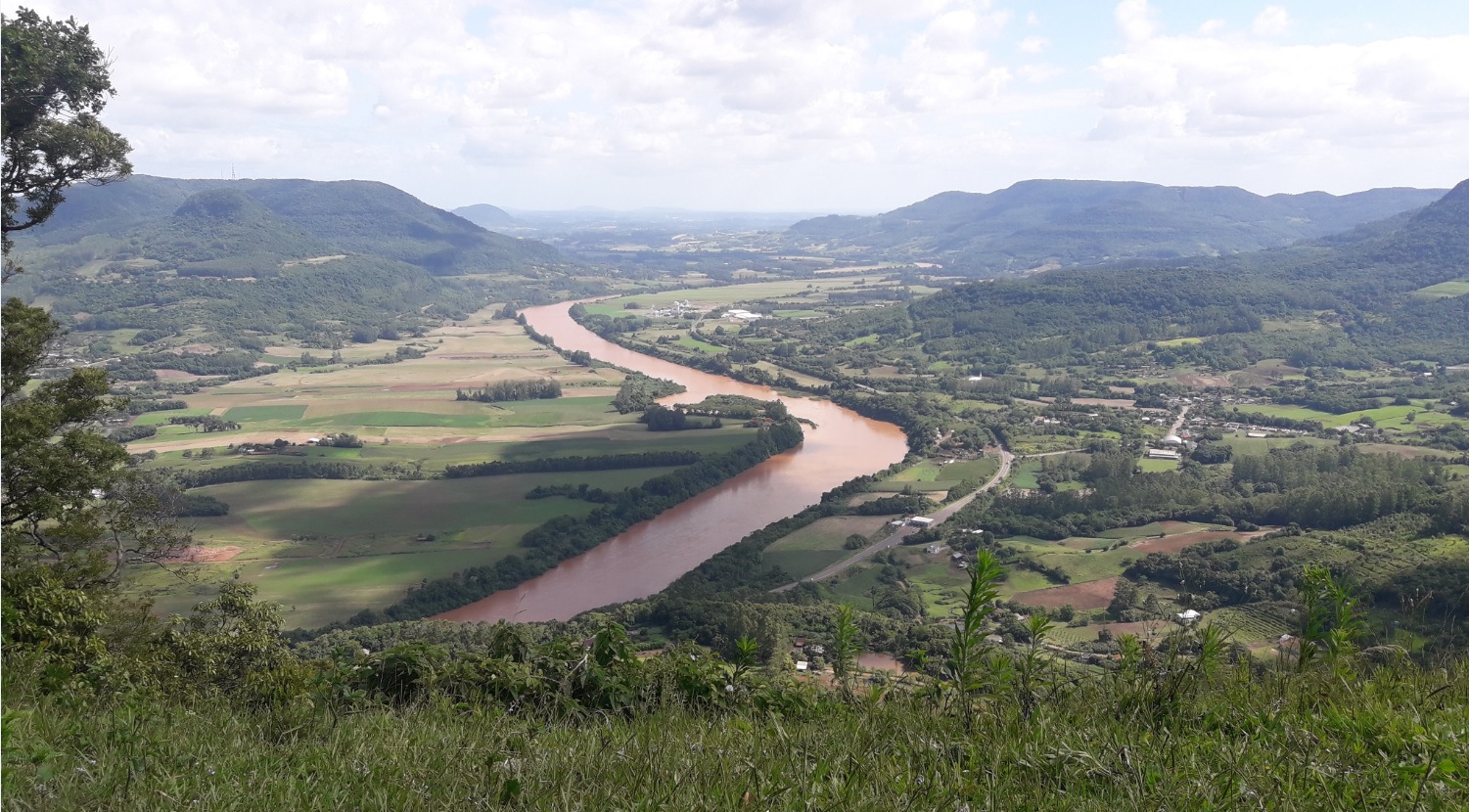
View of the Taquari River valley, from Morro de Palmas (city of Arroio do Meio) (photo by: Sofia Royer Moraes)
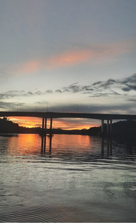
Taquari River (photo by: Janaína Santos)
Editor notes:
- About the author: Sofia Royer Moraes is an Environmental Engineer and a PhD student in Water Resources and Environmental Sanitation at IPH, Universidade Federal do Rio Grande do Sul (UFRGS), Brazil, under the supersivision of Dr Walter Collischonn. She is also a lecturer at CETEC UNIVATES in Brazil.
- For more on flood marks: you may also be intrerested by this HEPEX blog post on flood memory and historical marks of high waters.
December 17, 2020 at 12:48
Lindo trabalho da minha Amiga Sofia… E a foto de minha autoria… linda demais… 🤩🤩🤩
December 17, 2020 at 13:12
Congratulations!!